


Welcome to Sileby
Welcome to the Sileby NatureSpot page which gives local residents the opportunity to find out about, and contribute to, our knowledge of the wildlife in the parish. Just click on the headers of these stories to read more.

Selected parish/ward / Wild Places / Footpaths / Parish/ward boundaries
To find out more about local Wild Places (red boundaries on the map), visit the Wild Places page. Contact NatureSpot if you have an idea for any additional Wild Places.
Sileby sits in the Soar Valley, between Leicester and Loughborough.It has a long history which dates back to 840AD when it was settled by the Danes.
The River Soar forms part of the parish boundary and much of the surrounding farmland in the south-west is low-lying and part of the flood plain. The Sileby Brook bisects the village, providing further aquatic habitat in the area.
Parish/ward species count:
Thanks to the following for supporting this page:

![]()
Welcome to the Sileby NatureSpot page which gives local residents the opportunity to find out about, and contribute to, our knowledge of the wildlife in the parish. Just click on the headers of these stories to read more.
We need more wildlife observations from around Sileby. So, if you've seen a species you recognise, from a Blue tit to a Bluebell, click on the header to find out what to do.
Sileby Parish Council has joined the Leicestershire verges biodiversity project and has taken on the management of a verge alongside the Sileby Brook to improve it for wildlife. Read more on the Sileby Brook verge Wild Place page.
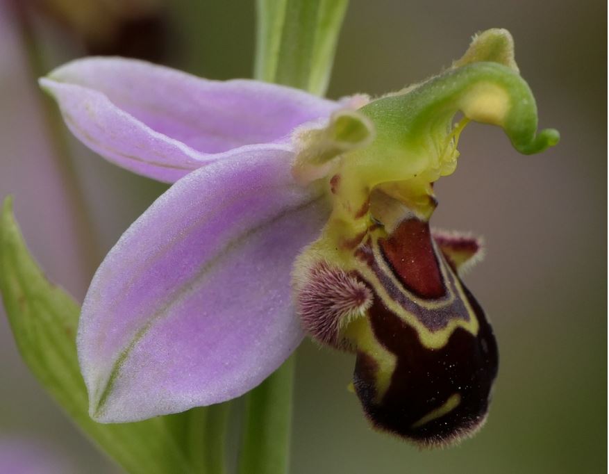
This stunning Bee Orchid was one of many found growing in the parish at Gypsum Works. The Bee Orchid flower mimics a female bee to lure a male into visiting and collecting pollen, which can then be transferred to another Bee Orchid plant to pollinate it.
The images and records below are all from the parish/ward and have been submitted by members of the public.
The latest images and records displayed below include those awaiting verification checks so we cannot guarantee that every identification is correct. Once accepted, the record displays a green tick.
In the Latest Records section, click on the header to sort A-Z, and again to sort Z-A. Use the header boxes to filter the list.