

Sileby, Cossington Rd verge
Selected Wild Place / Other Wild Places / Public Rights of Way / VC55 boundary
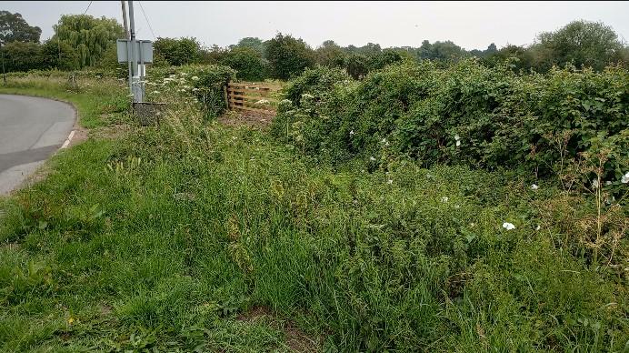
The verge is on Cossington Road at the southern edge of the village.
Road verge
Site species count:
This verge being managed to improve biodiversity as part of the County Council/Parish Council Verges Biodiversity Project. By allowing the grasses and wildflowers to grow and managing the verge as a wildflower meadow it will support a much greater variety of wildlife species.
The verge has been surveyed by NatureSpot and the species recorded can be seen on this page. However, other species will appear throughout the year so we will get a much better understanding of the nature value of this site if more records are collected. Local residents are therefore encouraged to add records of what they see. Please take a photo if possible and include it with your record, using NatureSpot's Submit Records form. Your record and any photos will then appear on this page.
Mowing will stop between April and August to allow the grasses and wildflowers to grow and bloom, providing food and cover for a wide variety of insects and other creatures.
A list of all the species recorded at the site, together with any images taken, appears below.
Note: the verge boundaries shown on the map are indicative, please refer to the signed/staked areas area on the ground for the exact location.
The records and images below may include those from adjacent sites if the grid reference submitted with these records overlaps the boundary of this Wild Place.
The latest images and records displayed below include those awaiting verification checks so we cannot guarantee that every identification is correct. Once accepted, the record displays a green tick.
In the Latest Records section, click on the header to sort A-Z, and again to sort Z-A. Use the header boxes to filter the list.